


Project Name: Almere Oosterwold – Experience of Nature
Location: Almere, The Netherlands
Category: Academic
Project Team: Carlos Dias, Joyce Lokate, Silko van der Vliet and Yokal van Boeckel
Project Year: 2012
Location: Almere, The Netherlands
Category: Academic
Project Team: Carlos Dias, Joyce Lokate, Silko van der Vliet and Yokal van Boeckel
Project Year: 2012
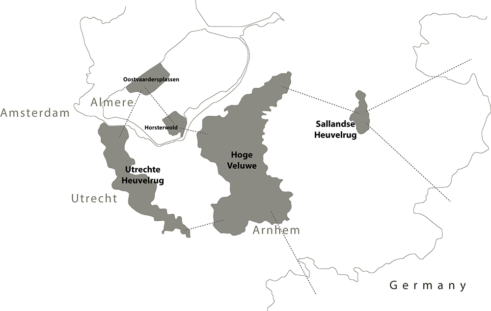
|Above: Location map and connections
This project takes place in the eastern part of the city of Almere, which comprises the expanded area of Almere Oost as well as the yet-to-be-established ecological corridor, called OostvaardersWold. This area lies in part of the Flevoland polder in the Netherlands 30km far from Amsterdam.

|Above: Climate change word cloud
The assignment focuses on Almere Oosterwold in accordance with the Almere Principles, the OostvaardersWold ecological corridor and the changing climate. It works out in different levels of detail such national, regional and local. In this scenario is intended to develop recreation features that reflect strong and intensive interactions with nature to achieve a unique environmental experience and this requires concentrated animal and plant populations within the polder conditions, making good use of its ecological possibilities. A good connection with Amsterdam and the nature reserve takes on supra-regional ecological importance and aims to national and international tourists

|Above: Layers of the concept
Nowadays, after thirty years since its inception, this area is occupied by agriculture lands and residential areas, working ideals and organic growth within a green environment. The main landmark in this region is the Oostvaardersplassen, one of the most special nature reserves in The Netherlands which lies on the north part of the area. One of the goals is to connect the nature reserve to the country’s most extensive nature area, the Veluwe. Almere is on the threshold of a new housing extension, increasing the households in 18.000, to give a much-needed quality boost to the northern Randstad region.
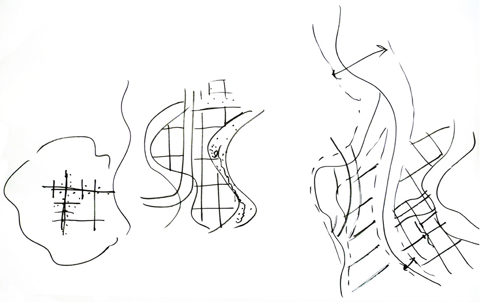
|Above: Hand sketches – urban growing vs. nature

|Above: Urban grow principles

|Above: Urban grow principles
The master plan is the translation from the vision and concept. All the gradients are quite clear and they act as a sieve for the wild animals towards the dense urban spaces. The design of the elements like lakes, rivers, swamps and forest are based on the soil under layer, mainly on the ground subsidence being the most on the north side of the area and the least in the south. Therefore the north part of the area has open and wet character and the south a dry and a lot of forest. This scheme is also used in the design of the corridor.
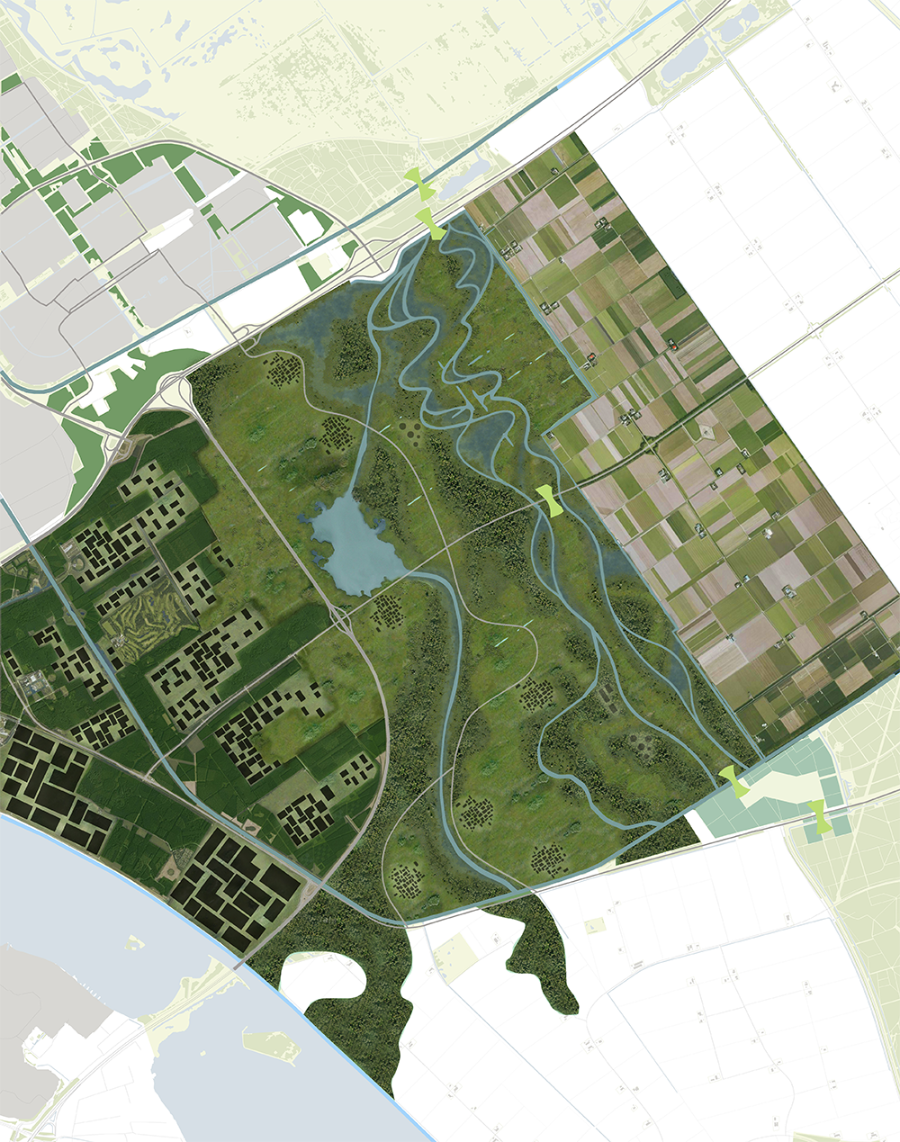
|Above: Masterplan

|Above: Detail plan and the section showing the gradient of density and different atmospheres
A new design for Oosterwold was proposed along with the existing policies for Almere 2.0. Practical phasing options provide a framework for continued development as necessitated by increased visitation levels. Additionally it was proposed to establish this area as a leading contributor in field of environmental and ecological education opportunities due to climate change.

|Above: Phasing diagram

|Above: Polder system
The intervention area is endangered due to climate change once it is mostly located under sea level. Water is being pumped out of the polder continually and thereby raising the salty underground water which can threaten the biodiversity of species and the agriculture lands. Therefore, as well as creating the new settlements, it is also important to keep in mind all the ecological and environmental issues implied.

|Above: Housing and "green fingers" - Dry season

|Above: Housing and "green fingers" - Wet season
The intention of the plan is to create a new sustainable way of living, keeping the nature closer to housing and combining the recreation activities with both features. To achieve this goal, the regional and international tourists were taken into account as well as the inhabitants of the new extension in order to establish all the features in the highest spatial quality and through educational programs, improve this quality and make people more aware of climate changes. The connection with Almere and Amsterdam played an important role in this assignment too.

|Above: Urban atmosphere

|Above: Visualization of ecotourism on the green corridor
The concept illustrates the relations between the research, the underlaying structures and recreation. The green corridor design was merged into the proposal to make it as a unique plan. The main point of the design is the gradients and transitions created in the landscape and also the integrated recreation.

|Above: Stream at the green corridor

|Above: Wild areas natural succession

|Above: Viewpoint towards Oostvaardersplassen
You can have access to the complete report here


